Guiding principle
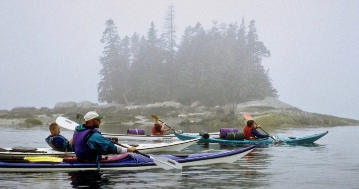
Our Trip Planning can regularly involve an open crossing, paddling at night or hours in a fog. In any such situations, you’re likely to have a crossing of 1-3+ miles, or you may need sort out which of many islands to paddle amongst – all require the ability to plot and follow a course…a fundamental skill of good seamanship.
Performance Objectives
- Paddlers should be able to plot a course using several techniques.
- Paddlers should also be using their piloting skills in following a course
- Paddlers should be comfortable and clear on using True North and Magnetic North, with Magnetic North being their primary use and reliance
How to adjust for magnetic north
- When using parallel rules to plot a course, read magnetic bearing off the inside compass rose.
- When using an orienteering compass, seat of the pants, or Small craft Nav-Aid know when and how to add or subtract magnetic declination.
- In Maine: True – Mag: Map to the world add 20o (North is 20, East is 110, South is 200, West is 290)
- In Maine magnetic variation is to the West of true North
- Re-structure/re-line your chart to draw Magnetic North lines on your chart (Parallel to the magnetic N-S axis on the compass rose)
Plotting a course
A course is the path traveled by the kayak. There are a number of situations where the paddler must do more than simply point their kayak at a landmark. Night paddling and fog along with large crossings where the destination is not clearly visible are all situations that call for paddling a plotted course.
Plotting a Course Using a Compass
- Draw a line on the chart from starting point to finish point (rum line)
- Ignore the needle. Use the compass as a protractor
- Place the base plate of the compass along the rum line so direction of travel arrow points toward the finish point on the chart
- Turn the dial so orienting lines are parallel to N-S grid lines on the chart (for a True Heading) or parallel to a magnetic N-S line (for a Magnetic Heading). Be certain that the North symbol on the compasses dial faces North on the chart
- Read the number off the index line
- Adjust for magnetic variation (add 20o in Maine if you took a True course reading)
Plotting a course using a Small Craft Nav-Aid©
- Place the center of the Nav-Aid on the starting point
- Rotate the Nav-Aid so the N-S axis on the Nav-Aid runs parallel to the North-South lines on the chart (Magnetic or True)
- Extend the bearing line so it intersects with the finish point.
- Adjust for magnetic variation (add 20o in Maine 20oW)
(Alternate method is to draw a line on the Nav-Aid with indelible marker that corresponds to magnetic variation and then line this up with N-S lines on the chart. Bearing read off Nav-Aid then corresponds to magnetic North)
Plotting a course using Parallel Rules
- Line up the parallel rules between the start and finish points
- Walk parallel rules over so it intersects the compass rose
- Read the true bearing off the outside rose
- Read the magnetic bearing off the inside rose
Limitations: Must be done on a flat surface. Impossible for paddlers to plot a course using parallel rules while afloat; also difficult to store in a kayak.
Using Ranges or Transits
Be comfortable regularly implementing, monitoring using a Range or Transit to help you stay on course, to measure your wind or current drift to evaluate a potential collision course. Ranges are our most used tool in Practical Navigation
Tasks/Activities
- Plot a course from Pumpkin Nob to the SE corner of Overset using each of the methods while on land.
- Explain how they plotted the course to other students or the instructor
- Have students plot a course while afloat either using a Small Craft Nav-Aid, an orienteering compass, eyeball, transit method
- Discuss advantages and disadvantages of different methods for plotting a course.
Assessment
- Students should demonstrate the ability to plot and follow a course using at least one of a number of methods while afloat and on land.
- Students should be able to state the difference between heading, bearing, and course.
Other Important Trip / Float Plan factors or variables
You will find weblinks to most of the following data from our Weather Board: https://maineislandkayak.com/ocean-school/weather/
- Weather Forecast: Land, Coastal, Off-Shore
- Wind & Wave height & Period
- Swell height & Period
- Water temperature & Dew Point
- High Tide Time & Height
- Low Tide Time & Height
Guesstimated Current Speed & Time of Max/Slack Flood Tide + estimated direction
Guesstimated Current Speed & Time of Max/Slack Ebb Tide, + estimated direction
Note any “safety zones” – wind, swell, waves, current, traffic, evacuation locations. Also note any crux or other “danger/exposure zones” – tidal depth, break/surf, no landing zones, traffic.
Note any landmarks, lights, buoys, etc.
Any legs or sections favor a special group paddling shape, pattern, position?
Route, distance, time to appropriate medical care?
Emergency numbers of that venue? USCH, medical, state police, marinas, channels?